 Frisco Adventure Park
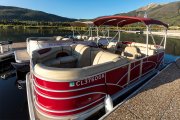 Frisco Bay Marina
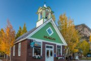 Frisco Historic Park & Museum
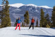 Frisco Nordic Center
 Frisco Youth Camps & Programs
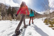 Activities
 Adventure Responsibly
 Dining
 Lodging
 Shopping
 Ski Resorts Near Frisco
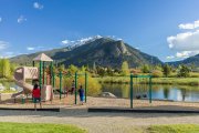 Parks
ParksDirections to Frisco
Frisco is located in the heart of the Colorado Rockies just 95 miles from Denver International Airport. It is a quintessential mountain town with six world class ski resorts within minutes of its charming Main Street. Frisco is also an exceedingly walkable and bikeable town with great free public transportation, making it very doable to leave your car at home or parked during your visit.
From Denver International Airport
- Frisco is located 95 miles from Denver International Airport.
- Take I-70 West to Frisco (Exit #203).
- To get to Main Street head south on Highway 9 (toward Breckenridge) for .5 mile to Frisco Main Street and turn right (west).
From Utah/Grand Junction
- Take I-70 East to Frisco (Exit #201) at Frisco Main Street.
- 26 miles from Vail, 86 miles from Glenwood Springs and 170 miles from Grand Junction
Transportation
Frisco is a hub for public transportation in Summit County, and encourages the use of multi-modal transportation to get to and around Town. Please visit GoI70.com for more information on public transportation, carpooling, and parking options along the I-70 Corridor.
The Frisco Transit Center is located between Safeway and Whole Foods in Frisco at 1010 Meadow Drive. The Summit Stage, Bustang and Greyhound bus stop here, as well as many airport shuttles and local transportation services.
At just under 2 square miles with miles of trails and recreation paths, Frisco is also ideal for pedestrians and bikers.
Frisco Electric Carshare Program
Colorado CarShare is a non-profit organization that operates over 75 carshare locations throughout Colorado, with four locations in Summit County. With help from Xcel Energy, who provided funding for carshare charging stations to be installed adjacent to the existing chargers on 3rd Avenue, Frisco is now able to offer an electric carshare option to locals and visitors.
To use the vehicle, the first step is to sign up for membership at carshare.org and use the promo code FRISCO_X which will waive the application fee and will add $50 in CarShare credits to the first 100 new Frisco members. After becoming a member, the carshare vehicles can be reserved up to four months in advance and are available for anything from quick trips (15 minutes) to multiple days. Members simply retrieve the vehicle at the time of their reservation and return it to the same spot when their trip is complete.
Summit Stage – Free Public Transportation in Summit County
- The Frisco Transit Center is a main hub for the Summit Stage, which is a free bus service providing transportation throughout Summit County.
- Bus service is available to most ski areas, shopping centers, medical centers, and some residential areas in Summit County. The Summit Stage runs to Boreas Pass, Breckenridge, Copper Mountain, Dillon, Dillon Valley, Frisco, Keystone, Silverthorne, Summit Cove, Warrior’s Mark, and Wildernest.
- View Summit Stage routes and the real-time bus locator with the Summit Stage SmartBus system.
Bustang and Pegasus – Affordable Regional Transportation Services from the Colorado Department of Transportation
The Colorado Department of Transportation offers two services, bus and large passenger vans, to and from Frisco. Both are very affordable and stop at the Frisco Transit Center which is located behind Safeway in Frisco.
- The Bustang West Line runs from Downtown Denver to Glenwood Spring with daily pick-ups and drop-offs at the Frisco Transfer Center behind Safeway. Advance Bustang ticket purchases recommended. For more information visit the Bustang website or call 800-900-3011.
- Pegasus travels on I-70 (using Express Lanes when available) between Denver and Avon, with stops at Denver Union Station, Denver Federal Center, Idaho Springs, Frisco, Vail, and Avon and it connects to the Bustang West Line if you wish to go further west. Advance Pegasus ticket purchases recommended. For more information visit the Pegasus website or call 800-900-3011.
Greyhound Bus
The Greyhound bus service picks up and drops off at the Frisco Transfer Center behind Safeway. Check out Greyhound’s website or call Greyhound Customer Service at 800-231-2222 for ticket information and destinations.
Additional transportation options & services
Please contact each individual transportation company for their current prices and service offerings.
In alphabetical order:
- 453-TAXI
Service from Summit and Eagle Counties- 970-453-8294. - Black Mountain Limo
Private car service locally, to the airport and from resort to resort. - Caravan
Mountain bound carpool app. - Epic Mountain Express
Airport shuttle service. - Fresh Tracks Transportation
Airport shuttle service. - Lyft
Lyft is available on a limited basis in our mountian community, and we would suggest not relying on this service being abundantly or conveniently available while visiting. - MTN Shuttle
Airport shuttle service. - Peak One Express
Airport shuttle service. - Stagecoach Limousine
Summit County limousine service for special events, or just traveling in style- 970-390-3599. - Summit Express Transportation
Airport shuttle service. - Treadshare
Carpooling app. - Uber
Uber is available on a limited basis in our mountian community, and we would suggest not relying on this service being abundantly or conveniently available while visiting.
Travel Advice
Spend More Time in Frisco and Less Time On I-70
I-70 is the primary route to Frisco. I-70 is congestion-free the majority of the time and with just a little bit of planning you can have “More Mountains and Less Traffic”. Learn the best times to travel, access real-time road & traffic resources, get great Sunday deals and more by visiting GoI70’s website.
Mountain Express Lane
An eastbound toll lane runs between Empire and Idaho Springs and operates during peak travel times. Before using this lane keep in mind that the amount of traffic determines pricing, ensuring the lane is always moving reliably. If you don’t have an express toll pass, you will be billed through a license plate toll at a higher rate.
Traction Law / Passenger Vehicle Chain Law
If conditions require, the following laws could be implemented and CoTrip’s website is the best place to find up to find real time updates on road conditions and restrictions.
- Traction Law: Motorists need snow tires, mud/snow tires, or a four-wheel/all -wheel drive vehicle – all tires must have minimum 1/8 inch tread.
- Passenger Vehicle Chain Law: Every vehicle must have chains or an alternative traction device (like an AutoSock).
Colorado Department of Transportation (CDOT)
For all real-time road condition information visit: CoTrip